
By Julia Riopelle, SciTech Editor
Unmanned aerial vehicles (UAVs) are becoming more popular within the environmental sector for remote data collection. Dangerous conditions, such as mountainous terrain or unpredictable environmental hazards, often make it difficult for scientists to collect vital information. An international project, ABOVE, brought together researchers from all over the globe working to design UAV which can stably fly in dangerous volcanic conditions.
Aerial-based Observations of Volcanic Emissions (ABOVE) was an international project led by UCL lecturer Dr Emma Liu, with aims of designing Unmanned Aerial Vehicles (UAVs), a.k.a ‘drones’, in order to monitor volcanic activity from safe distances. ABOVE has created a collaborative network of specialists from the University of Bristol, as well as other UK locations, Italy, USA, Papua New Guinea, Sweden, Germany, Costa Rica, and New Zealand.
The Bristol team comprised Dr Kieran Wood, Dr Tom Richardson, and Mr Robert Clarke from Aerospace Engineering, Dr Watson from the faculty of Earth Sciences, and Professor Jim Freer from Geographical Sciences. These Bristol specialists, along with the international team participating in the project, have conducted the first successful UAS flights at Manam volcano in Papua New Guinea.
Dr Richardson and Dr Watson have already designed drone systems for a wide array of applications. The two are in current partnership with Bristol Zoological Society, where they are using drone technology to monitor numbers and movement of the IUCN red-listed Kordofan giraffe in Cameroon.
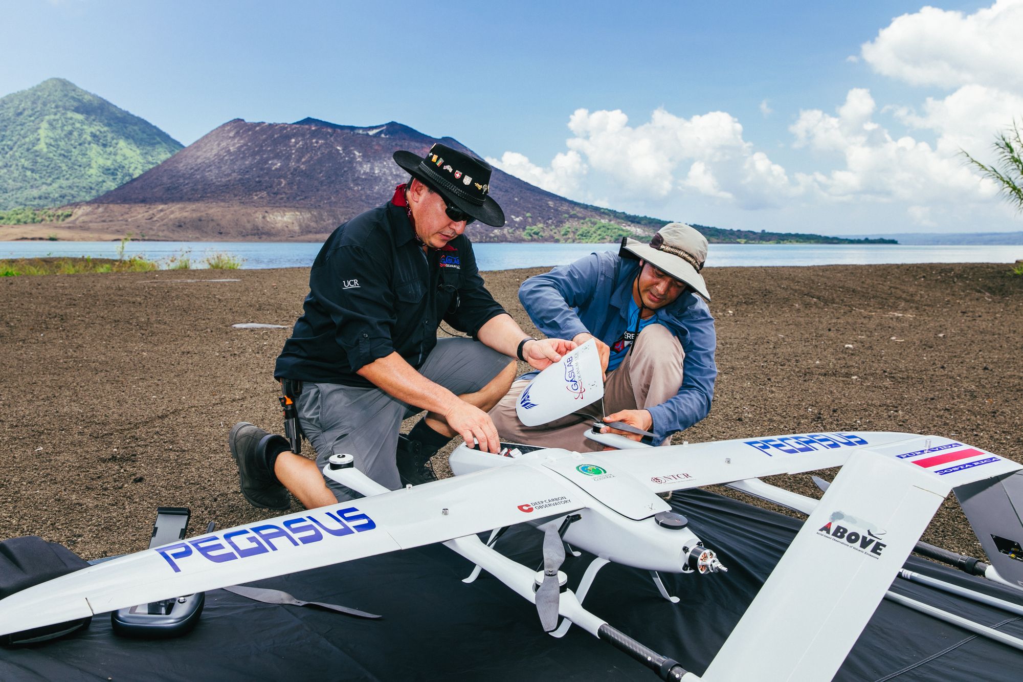
Meanwhile, Dr Wood has previously tested UAVs for the measurement of volcanic emissions levels in Chile. With support of Bristol Flight Lab and in cooperation with researchers from the University of Cambridge, the team built the black widow drone.
'The black widow frame was designed to provide enough stability to survive the harsh conditions within a volcanic plume, whilst also being foldable to be carried up the glaciated summit', explains Dr Wood. 'We also used the same drone in expeditions to Guatemala and Stromboli Volcano in Italy whilst developing the technology.'
Satellite images have shown that the 10 km wide volcano is exhibiting strong emissions with large plumes. The volcano was particularly active between 2004 to 2006, where the immense eruptions displaced much of the local population.
ABOVE aims to understand the potential threat of this environmental hazard, so that nearby towns can evacuate in time in the case of another eruption. Thick vegetation, mountainous landscape, and unpredictable volcanic eruptions have so far made it unsafe to make traditional on-sight measurements at this volcano.
Volcanos play a huge role in releasing stored carbon into the atmosphere within extremely short periods of time. Carbon is the most integral molecule in living organisms and has had massive impacts on the climate, yet we do not really know how it behaves below the Earth’s surface.
The data collected from Manam and other sites contributes will also contribute to a larger project, which aims to analyse deep carbon reservoirs and measure how much carbon they currently store. The researchers estimate quantities by studying the microbial and viral biosphere of these reservoirs, whilst comparing them to continental crust and seafloor environments. By studying carbon dioxide fluxes released during volcanic activity, one can learn more about its behaviour underground.
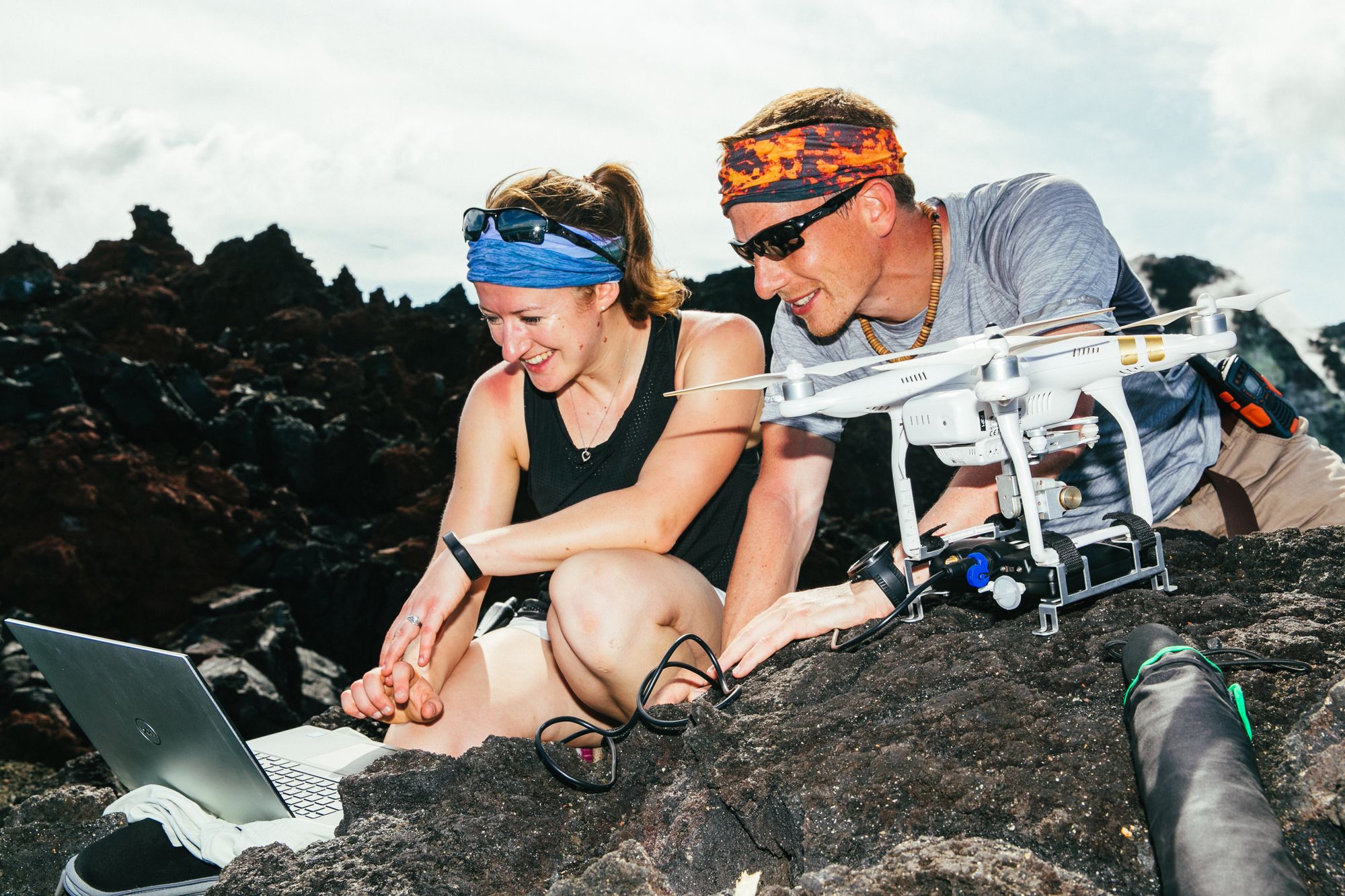
The harsh unpredictable environments and turbulent volcanic plumes, however, have posed significant challenges for airframe stability, robustness and in-flight remote control of the drone technology. Volcanic plumes are heterogeneous mixtures of volcanic particles and thermally buoyant gases. These plumes can reach several kilometres in height and be carried thousands of kilometres via wind currents.
As the summit of Manam is further away and at higher altitudes than some of the volcanoes previously studied, the team built the Titan aircraft - a twin-propeller, v-tail, fixed-wing drone, which is more suited to these conditions. Titan has a payload of 1 kg and can reach altitudes of 2300 m at 10 km distances. Dr Wood, 'This vehicle was advantageous because it could be launched by hand and has the ability to eject a parachute when needing to land on uneven terrain.'
The critically endangered Kordofan giraffe receives help from above
University of Bristol drone research to be used in future offshore wind farms
The international team has now conducted three flights into Manam’s volcanic plume, where its miniaturised gas sensors and spectrometers were able to directly sample near-vent measurements of carbon dioxide. The samples were collected and analysed within just a few hours. The drones measured the ratio of sulphur to carbon dioxide levels, which can identify the nature of the volcano’s magma and helps predict how likely an eruption is.
Once perfected, Unmanned Aerial Systems have huge potential in gathering important data from remote locations, where it would otherwise be life threatening to venture for field exploration.
Featured Image: ABOVE / Emma Liu
In what other applications do you think drone technology could come to our rescue?


